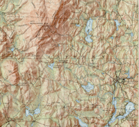
USGS Shaded Relief Version of the Monadnock QuadrangleThis version of the USGS Monadnock quadrangle was produced in shaded relief to highlight Mount Monadnock. Consequently, the adjoining Peterboro quadrangle was not so issued. Because of this only the portions of Jaffrey that fall within the Monadnock quadrangle are included. 1) Monadnock New Hampshire |
Click here to download and view a pdf of the 1:62,500 shaded relief topographic map of Jaffrey (1949). Two sources for historical USGS maps of New Hampshire or other New England states are Maptech and the University of New Hampshire. |